From Duluth to the Canadian border, LHB’s designers have influenced the roadways along the Lake Superior shoreline.
We’ve reworked paths and parking lots, intersections and information kiosks. We’ve helped rehabilitate old bridges, enhanced environmental sustainability, and highlighted local history in unexpected and unique ways. You can see our completed work in Grand Marais and Grand Portage and view projects-in-process up and down the entire shore.
As you head north to celebrate Labor Day, check out fall colors, or ski at Lutsen in the months ahead, take note of the LHB projects on the list below. We’d love to know what you think of them. We certainly hope our designs make your travels along Lake Superior safer, more comfortable, and more scenic, perhaps, even more fun.
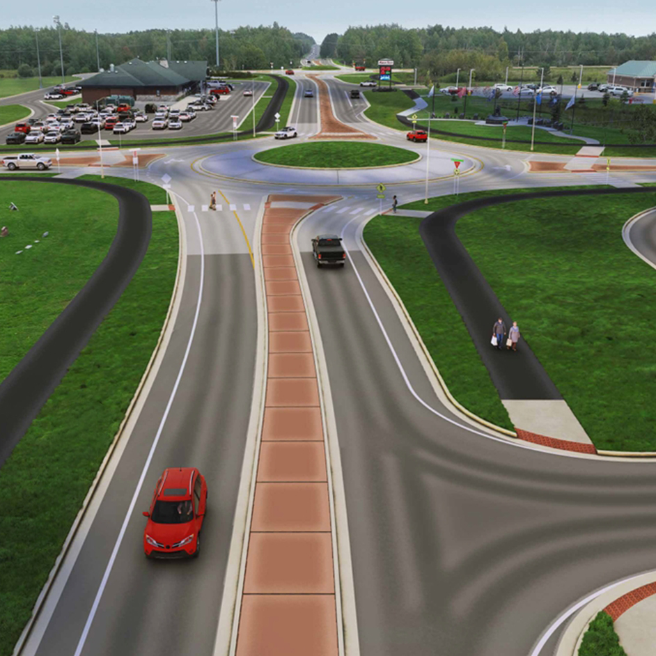
London Road

Most road trips up the North Shore essentially begin in Duluth, on London Road. The busy thoroughfare connects numerous municipal and residential streets to the heart of the city and serves as a popular commuter route to various destinations and places. MnDOT recently surveyed the community for comments regarding the corridor’s needs and challenges, then hired LHB to deliver preliminary and final design services. Since the start of the year, LHB and MnDOT have been working with the project stakeholders and community members to work towards a solution that best serves everyone. The planned changes, focused on reducing traffic congestion, improving vehicle and pedestrian safety, and making the roadway more bike-friendly, are scheduled to begin construction in 2025.
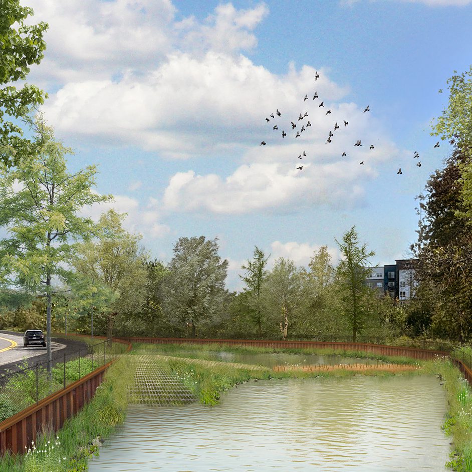
French River Bridge

For nearly a century, the open-spandrel arches of the French River bridge just north of Duluth attracted photographers and plein-air painters. So when LHB drew up plans to replace the 99-year-old span, aesthetics were a key consideration. The replacement, a single-span prestressed beam structure, pays homage to the original bridge with a single sleek arc, and an ADA-accessible interpretive installation showcases the history of local fisheries. The result? Another reason to stop and explore the wonders of the North Shore. [Read more about this project.]
Stewart River Bridge

Stopping for a slice at Betty’s Pies is a time-honored tradition on many North Shore vacations. But entering and exiting the restaurant’s parking lot has always been a little complicated, in part because of its proximity to the Stewart River, traversed by a short two-lane historic bridge, and a lack of dedicated turn lanes. Soon, however, a second bridge will be completed, allowing for a divided highway: southbound traffic will flow across the new span, while northbound will travel over the old bridge (slated for rehabilitation). When all is finished, the new design, by LHB, will feature both right and left turn lanes, as well as new lighting and pedestrian accommodations that enhance the safety of visitors crossing the highway to reach the shoreline.
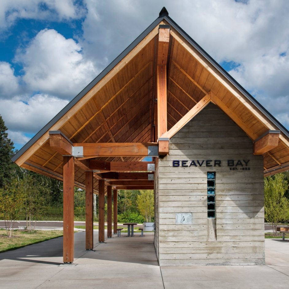
Beaver Bay Trailhead

The Beaver Bay Trailhead, where Highway 61 meets Lax Lake Road, is a popular stop for cyclists on the Gitchi-Gami State Trail, which parallels the edge of Lake Superior. In 2016, upper and lower parking lots designed by LHB were installed and a host of park amenities were added: benches, bike racks, retaining walls, and landscaping. Of particular note, though, is an eye-catching combined restroom facility and picnic shelter. Constructed of heavy timber and board-formed concrete, the simple but elegant structure reflects the mining and forest industries that have shaped the region. (The durability of the materials also means the shelter requires minimal maintenance.)
Grand Marais

Visitors returning to Grand Marais this summer or fall will discover that the detours and construction along the city’s main artery are finally gone, replaced with roads and intersections designed by LHB to calm traffic, improve safety, accommodate pedestrians and cyclists, and clearly delineate parking areas. The new infrastructure will help the city handle a burgeoning crowd of tourists. LHB worked directly with the city to add boulevard plantings, pedestrian scale lighting, benches, planters, kiosks, art pedestals and bike racks. What’s less evident is the storm sewer and utility work that lies below the roadway, an engineering feat that involved removing several thousand tons of contaminated soil and blasting through the granite bedrock that underlies the North Shore’s thin soils. [Read more about this project.]
Grand Portage

The last 17 miles of the North Shore Scenic Drive, before it ends at the U.S.-Canada border, traverse Gichi Onigaming, the homeland of the Grand Portage Anishinaabe. Because many residents cross the highway not only by vehicle but also on foot, bicycle or ATV, safety was a key concern when the roadway was rehabilitated in 2020-2021. LHB’s design team worked with MnDOT and the Grand Portage band to add turn and bypass lanes, enhance overall lighting, upgrade drainage and guardrails, and improve sight distance, signage, and ATV/pedestrian crossings. Remarkably, the entire project was finished ahead of schedule and $1 million under budget. [Read more about this project.]
Got a project you’d like LHB to design? Contact one of our team members today!