

Located just north of Duluth, Rice Lake is a community in transition. Unlike Duluth, a city with both long-established boundaries and a steep topography that limit building and expansion, Rice Lake is a relatively new municipality (converting from a township to a city in 2015), with a small population (just 4,112 residents, per the 2020 census), and plenty of room for development. What the young city lacks, however, is the infrastructure to support future growth.
The central spine of the community is Rice Lake Road, which links Duluth to the Iron Range. As an access-restricted arterial carrying significant traffic, Rice Lake Road has begun to show congestion and safety problems in recent years. After a study by St. Louis County found numerous opportunities for improvement, the county, in partnership with the City of Rice Lake, sought and obtained federal grant funding to remake the road to support economic development and the anticipated increase in traffic.
One road, many drivers
The project affects multiple stakeholders in the region, many of which rely on Rice Lake Road and the surrounding roadway infrastructure. Duluthians have taken an interest in the project because the corridor’s non-motorized trails will eventually tie into the region’s growing trail network and, ultimately, the Lakewalk along the Lake Superior shoreline. The Duluth Airport Authority holds interests in nearby land and structures. Landowners and businesses along the route are directly affected, as are the everyday commuters, freight haulers, and aspiring developers who are eager for the project’s infrastructure to be completed.
For LHB’s engineering team, the project offers a rare chance to design infrastructure in such a forward-leaning approach, creating an environment that best serves the community today, and will also allow it to thrive tomorrow. LHB is serving as the prime consultant, handling consultant project management, stakeholder engagement, roadway and trail design, structural and drainage work, lighting, signing and striping, and utility coordination. KLJ, serving as a design partner to LHB, provides traffic engineering, environmental documentation, roundabout design, and public engagement, while Braun Intertec contributes soil borings and pavement recommendations. The plan reconstructs segments of three main county roads as urban sections with non-traversable medians, adds new city streets to connect them and provide additional access, and creates several commercial and residential zones. The design moves commuters and freight efficiently, provides access for businesses at key intersections, and accommodates the residential neighborhoods that will follow.
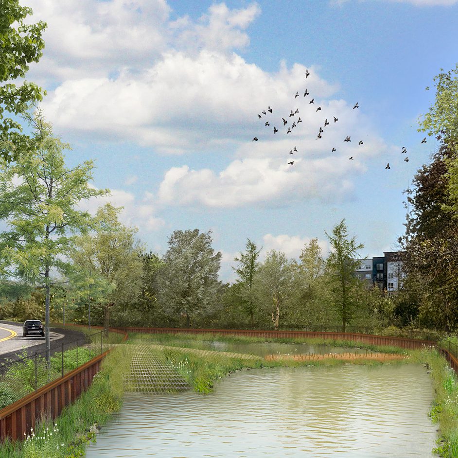
Trails, wetlands, and stormwater
Active transportation is central, not an afterthought, in the plan. The design adds more than five miles of new paved trail and walkways, including 3.5 miles of separated path along the east side of Rice Lake Road, eventually linking into Duluth’s system and the waterfront.
Routing those trails through the landscape introduces some complications, however. To reduce impacts to local wetlands, elevated boardwalks will be designed to allow the trail to cross with minimal disturbance, and the poor soils throughout the area will be addressed with careful structural design. Stormwater management is also a key concern in the region. As part of our work, LHB is identifying places to capture and treat storm runoff and discharge clean water to the surrounding wetlands.
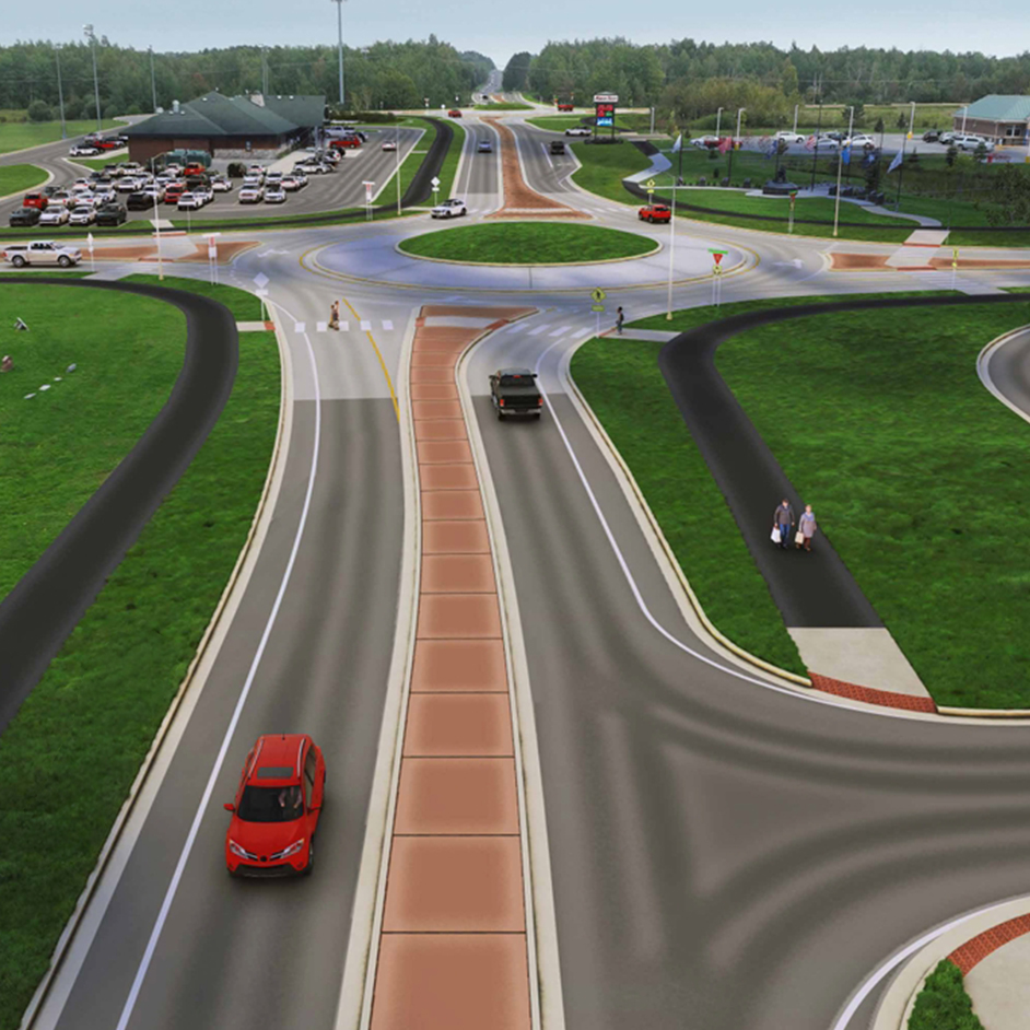
Four roundabouts for safer and more efficient travel
As part of the original design, two roundabouts were proposed. Roundabouts reduce serious crashes, keep traffic flowing without signals, and eliminate dangerous left turns. They can also serve as informal gateway monuments, reinforcing a city’s identity through landscaping.
To keep traffic close to the adjacent businesses and to avoid lengthy detours during construction, LHB proposed turning one of the new city connector streets into a temporary bypass. And to maintain safe access through that bypass, our team proposed two additional temporary roundabouts.
That construction staging idea, however, prompted a question: If the additional roundabouts are going to be built anyway, why not use them long-term to increase safety, control access, and reduce the paving required to add turn lanes? The two temporary roundabouts will become permanent features of the design, bringing the total in the plan to four.
The project recently passed the 30 percent design milestone and should be 60 percent complete by late summer. Final plans will be completed next spring, but a small segment of shared-use path will be bid early, obligating grant funding. The remainder is slated to bid in fall 2027, with construction running from 2028 through the end of the decade. ∎
Learn more about LHB’s innovative approaches to roadway design work.
Featured Image: Rendering by KLJ – Proposed Roundabout Concept at Rice Lake Road / Martin Road